Having worked for SRK on a wide variety of exploration projects, I’m sad to report that geological and structural mapping continues to be a largely undervalued exploration tool in the industry. Finding a geological map in the display booths at explorer’s conferences is a bit like the industry itself: high risk – low gain!
This lack of interest in mapping in part reflects the fact that market appetite is focused on vague declarations of “mineralised corridors” and “prospective structures”. And the fast pace at which exploration projects operate allows little time for mapping, which is perceived to be slow work. As a consequence, mapping skills are dying out, and many younger geologists lack the mapping skills needed to make sensible interpretations.
SRK believes that geological and structural mapping should be conducted early in any project, to form a solid basis for a cost-effective exploration campaign. The cost of initial geological mapping fades into insignificance when compared with drilling or regional geochemical or geophysical surveys. What’s more, the understanding gained by geological mapping allows a better definition of meaningful and cost-effective drill hole planning, defining target areas for geochemical or geophysical work and establishing a testable geological/structural model.
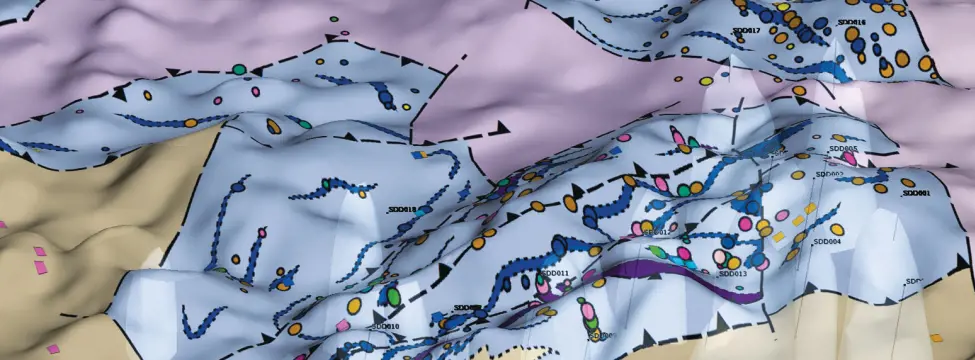
In recent years, the SRK Geology Team has developed advanced mapping capabilities using GPS-enabled tablet PC’s and mapping protocols that allow the digital capture of mapping data in the field, producing maps more quickly than ever before. A geological map in digital form and all attached databases are usually finalised within a week of finishing field work. The mapping data is integrated into a 3D environment (LeapFrogTM) to assist in cross-section generation and drill planning, and is presented to the client in GIS and LeapFrog format. SRK also works with a set of reputable laboratories to allow for quick sample returns for petrographic, chemical and even geochronological analyses, which may assist in geological interpretations.
Recent mapping work conducted by SRK Perth include iron, base metal and gold projects in Australia, West Africa, Southeast Asia and North America. The mapping has ranged from regional (1:50,000) to prospect scale (1:5,000) projects, sometimes incorporating 3D drilling data to aid interpretations.
SRK mapping has assisted clients to identify target areas, by recognising outcropping mineralisation, or structural interpretations, and where data are sufficient, has provided a testable geological model, in some cases, with exploration target sizes. Often, SRK is able to incorporate the surface mapping data into 3D geological models once drill data become available. This in turn leads to better constrained geological domains, and a more reliable resource estimate further down the line.

